DriveHeat: A heatmap app to find out how long it takes to drive somewhere nearby
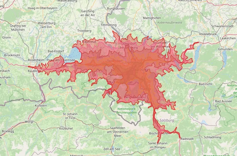
Since relocating to Wals near Salzburg at the start of this year, I’ve been exploring my new surroundings. At my old place in Griesstätt, driving time and distance “as the crow flies” matched each other fairly closely. Now, driving times from my current location are far more unevenly distributed. The Alps block the way to the south, the Austrian–German border lies to the northwest, and to make things even more complicated, the autobahn makes faraway areas surprisingly accessible. However, unless you’re willing to pay the Austrian toll, this advantage applies only when driving into Germany.
To get a clear picture of which areas are actually close to me in terms of driving time, I built an app using Claude Sonnet 4 and ChatGPT 4.1. It’s called driveHeat and displays driving times as a heatmap overlay around any address or coordinates provided by the user. It’s based on Leaflet and OpenStreetMap, and is hosted on GitHub Pages.
Check it out here: https://beyerl.github.io/driveHeat/
The app is open source under the MIT license. You can find the source code on GitHub: https://github.com/beyerl/driveHeat
[AI used only for spellchecking when writing this article]